Chinese engineers make sci-fi drone mapping reality
Share - WeChat


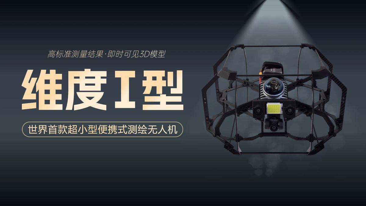
A scene from the science fiction film Prometheus, where explorers deploy a mini-drone that laser-scans caves to generate 3D models instantly, has turned into reality, thanks to the efforts of Chinese engineers.
On Tuesday, the Spatiotemporal AI Perception Technology Innovation Center at the Tianfu Jiangxi Laboratory in Chengdu, Sichuan province, announced that it has launched Dimension 1, the world's first ultra-compact portable mapping drone. It is designed to perform asset digitization scanning tasks in indoor environments.
- CPC members work against the clock to restore normal life in rain-hit Hunan
- Ceremony commemorates legendary ancestor of the Chinese civilization Fuxi
- Former KMT chair leads Taiwan delegation to honor Fuxi, Chinese culture
- Shanghai conference discusses occupational mental health in China
- Qingdao Summit strengthens global ties through multinational cooperation
- Chinese vice-premier calls for championing humanity's common values, promoting multipolar world


